Places to visit
What the papers say…
Kyrenia Harbour… must be one of the most beautiful sights in the world.
(Mail on Sunday ‘You’ Magazine)
Karmi (Kamaran)
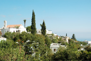
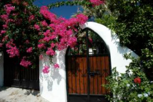 The picturesque village of Karmi (Karaman) is situated approximately four miles to the west of Kyrenia/Girne and is 1,000 ft above sea level, giving every house breathtaking views along the coastline.
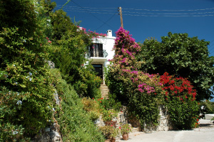
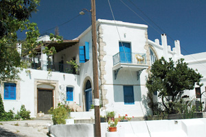 It is now undoubtedly the prettiest and most well-kept village in the north as all the houses have been restored in a traditional manner, often with flagged floors, beamed ceilings, stone arches and roof terraces set in an array of flowers, plants and trees which have been planted around the village.
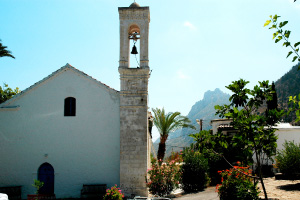 Karmi village situated to the west of Kyrenia, high in the mountains, was abandoned by its Greek-Cypriot inhabitants during the 1974 intervention. It soon became a ghost town and very run down, losing all its peace and charm.
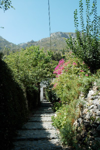 The Council of Ministers decided to put in action an innovative rejuvenation project in 1979 which would bring back to life this village of amazing natural beauty that has appealed to foreigners for a long time.
In 1983 the Ministry of Interior started to lease out the properties on 49 year renewable leases, mainly to people from the UK.
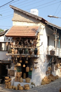 Slowly over the next seven years the infrastructure was improved by adding in new roads, water supplies and electricity. Great importance was shown to keep the character of the village whilst making sure that the new inhabitants had all their modern needs taken into consideration. Solar heaters are not permitted to be placed on the roofs, wooden rafters and rush mats were used for ceilings and height of water tanks is limited to 60cm above roof level in order not to spoil the village atmosphere.
The village shop stocks all the essentials, including fresh bread, acts as the post office and a source of general information. There are two bars; The Crows Nest pub is open all year round and Spot is open for the summer months. There are two restaurants; Levant, next to the church and Crows Nest in the lower village.
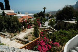 The old Greek Orthodox Church is now a museum and is open on most Sunday mornings around 11. The village is small and nowhere is really more than 5 minutes walk away.
From Karaman, several walks are possible. For the more energetic, Ilgaz is about 5 kilometers away to the west and Zeytinlik is about the same to the east. There are also tough trails up the mountains and along to St. Hilarion Castle, through the pine forest.
Karmi Necropolis
 In the archaeological excavations close to the Karmi village, tombs in the shape of rooms belonging to the Middle Bronze Age (c 1900-1625 BC) have been discovered. The human effigy in the corridors of one of these tombs is the oldest effigy found in Cyprus so far. The effigy symbolizes the Goddess of Fertility. Blue beads thought to have been gifts for the dead, and bowls belonging to the Minos civilization brought from Crete were found in the graves.
 In one of the tombs a Minoan ‘Kamares’ cup and blue faience beads from Egypt which suggest very early trading relations with Crete and Egypt were discovered. It is called ‘the tomb of the seafarer’ because it was believed ‘that the man probably walked down to the sea at Lapithos (Lapta) and took service with one of the vessels trading between the Syrian ports and the Aegean and that these objects are momentous of his travels’. These show the level of commercial activities with the neighboring countries in the Bronze Age.
Bellapais
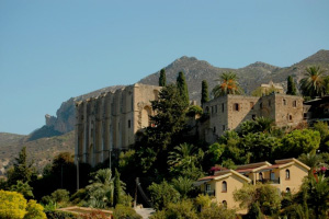 When famous British author Lawrence Durrell bought a house in the village of Bellapais, he felt “guilty of an act of fearful temerity in trying to settle in so fantastic a place”. He wrote: “Bellapaix, even in ruins, was a testimony to those who had tried, however imperfectly, to grasp and retain their grip on the inner substance of the imagination, which resides in thought, in contemplation in the Peace which had formed part of its original name, and which in my spelling I have always tried to retain. The Abbey de la Paix, corrupted by the Venetians into Bella Paise… It was to take me nearly a year to gain currency for the spelling Bellapaix, which is as near as one can get today to its original. But no such thought was in my mind that first spring morning as I walked in those deserted cloisters, touching the rosy stones of the old Abbey with an idle hand, noticing the blaze of flowers… and here and there, bursting from a clump of fallen masonry, cracking the rock triumphantly, the plumes of yellow fennel. In that silence the light airs of the plain climbed up to us, full of the small sound of birds as they stooped and dived in the blue gulf below. Somewhere near at hand came the rustle and dribble of spring-water feeding the flowers.” (Lawrence Durrell in Bitter Lemons – “The Tree of Idleness”)
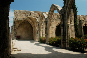 Situated south-east of Kyrenia on the side of a mountain, this twelfth-century monastery is a fine example of Gothic architecture of the Lusignan period and combines a church, refectory, dormitory and storage rooms grouped around an inner courtyard.
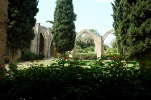 Perched precariously on a natural terrace, unchanged and unhurried since its colonial days, Bellapais abbey stands guard over the whole of the northern coastline, and is perceived to be one of the most important Gothic buildings in the Near East. Here, you can explore the impressive remains of the abbey, or simply relax with a cold drink and some quality food at one of the fabulous restaurants situated in and around the area. This 14th century Lusignan abbey with its fabulous location and pervasive atmosphere of calm is the perfect place to visit for anyone wishing to capture the true essence of Cyprus.
Ancient folklore suggests that those seated beneath the famous tree of idleness, become lazy and unwilling to work… the laid back atmosphere of Bellapais would certainly make this come across as being true!
Above the abbey lies the charming Bellapais village which is a maze of tiny lanes and narrow streets to get lost in. Bellapais, and its beauty, is legendary….. so put Bellapais at the top of your list of places to see and sample the Cyprus of a bygone age.
Karpaz
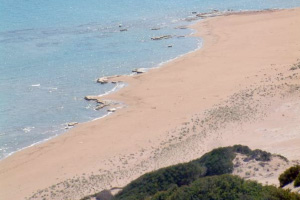
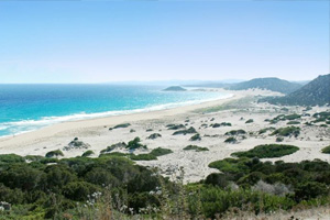 The Karpaz in North Cyprus is one of the most beautiful, unspoiled and tranquil parts of the Mediterranean and offers a stunning array of landscapes and scenery. If it’s peace and quiet you are looking for when you go for your summer holidays, this is the place for you. There are miles upon miles of clean sandy beaches with not a sole to be seen. Wildlife and plant lovers will also be in seventh heaven, especially in April/May, when the spring weather brings numerous species of animals and lots of flowers, many unique to Cyprus, to our unspoiled shores.
 Wild Donkeys in the Karpaz National Park area (Pan handle): There are approximately 250 wild donkeys which roam the plains. Generally black, but are sometimes ginger, you should approach with care.
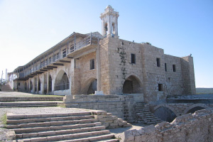
 As well as numerous Byzantine churches, the most notably the Monastery of Apostolos Andreas, the area boasts some of the finest countryside in the countryside. The Karpas peninsula has been called the nature reserve of Cyprus for birds, wild flowers, and sea fossils are to be found everywhere.
 This is one of the pilgrimage centres of Orhodox Church of Cyprus, and is at the tip of the Karpas peninsula.
It was once the Lourdes of Cyprus, served not by an organized community of monks but by a changing group of volunteer priests and laymen.
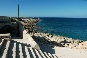
An enormous modern plaza of pilgrims lodgings frames the slightly older monastery buildings wrapped around the church. Below, the modern church steps lead down to a square, vaulted chapel, three baptismal basins fed by a sacred spring and an old wharf.
It was on this site that St Andrew briefly landed in Cyprus on his final missionary journey back to his Palestinian homeland. His footfall revealed a spring whose waters miraculously healed the blind captain of his ship.
Kyrenia (Girne) Harbour
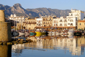
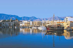 The historic Kyrenia harbour is situated on the north coast of Cyprus and has a 6,000 year long history, dating back to the time of the Byzantines.
At the entrance to the harbour is the imposing Byzantines Kyrenia castle which has been influenced by the Lusignans and then the Venetians amongst others. Originally built as a roman fort, the impressive castle is stacked full of history and is now home to an informative & interesting museum which houses the oldest shipwreck in the world dating back to the 16th century.
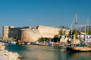
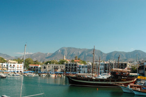 Nestled under the backdrop of the Five Finger mountain range and overlooking the calm sparkling waters, the harbour has an intoxicatingly serene atmosphere.
As the sun sets over Kyrenia the town centre and the harbour in particular, becomes alive with young and old as everyone makes the most of the unique atmosphere Northern Cyprus has to offer.
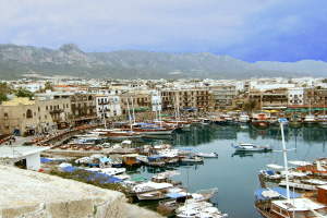
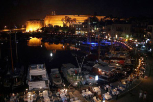
The streets are alive with stalls selling nik-naks and souvenirs, bars playing music until the early hours, and laughter coming from every table in every restaurant as the evening progresses.
Whether you want a quiet restaurant in the cobbled backstreets or a lively bar with music and dancing… Kyrenia and its harbour has something for everyone.
(Kyrenia (Girne) Harbour photo 6 (bottom right) courtesy of Graham Currey)
Salamis – Ancient Roman City
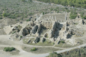
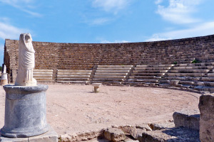 The ancient city of Salamis became the capital of Cyprus as far back as 1100 BC. The city shared the destiny of the rest of the island during the successive occupations by the various dominant powers of the Near East, viz the Assyrians, Egyptians, Persians, and Romans. The ancient site covers an area of one square mile extending along the sea shore. There is still a large area awaiting excavation and this is forested with mimosa, pine and eucalyptus trees.
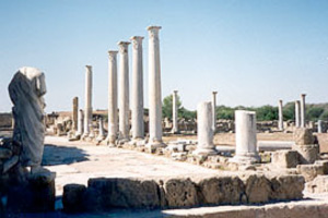 The finding of some gold coins bearing the name of Evagoras, 411 to 374 BC, is the first genuine evidence of the city’s importance. A severe earthquake destroyed the city in 76 AD after which the Gymnasium with its colonnaded Palaestra was built by Trajan and Hadrian. This is the most monumental part of the site but columns differ in size because after the second great earthquake of 331 AD, the Christians set up new columns which they dragged from the Roman theatre.
 The theatre with 50 rows of seats and a seating capacity of 15,000 is the second most spectacular sight. All around the buildings that have been excavated are many niches which contained marble statues, and those that can be seen are headless. When Christianity was adopted as a state religion, all these nude statues were to them an abhorrence, and were thrown into drains or were broken up. In fact, any indications of Roman pagan religion such as mosaic pictures were effaced or destroyed.
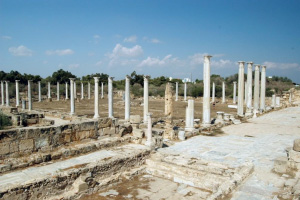 The Romans had an obsession about baths, and in the Great Hall buildings one can make out the Sudatorium (hot baths), the Caldarium (steam bath) and Frigidarium (cold baths). Before the Christian period, ie. before 400 AD, it was quite a colourful city; the marble columns were covered with coloured stucco, coloured statues, and numerous polychrome mosaics of which only a few are left. It was during the Christian period that walls with rectangular towers at regular intervals were built, but all that one can see of these today are mounds of sand dunes.
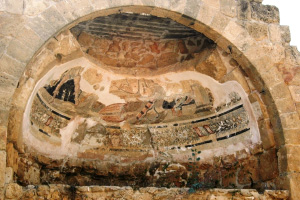
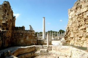 The late Roman period after 400 AD up to about 1100 AD is known as the Byzantine epoch, when the first great Christian churches, called basilicas, were built. The visitors should see the St Epiphanos and Campanopetra, for they are the largest churches in Cyprus.
About 674 AD, Arab invasion brought about the destruction of the entire city and the inhabitants fled south to build the medieval town of Famagusta (Magusa). There must have been a great change in the climate as the city was overwhelmed with sand, and only the tops of the columns peeped above. Coins of the Middle Ages, Lusignan period, were found around the basilicas, from which one can conclude that squatters lived in the ruins perhaps up to about 1300 AD.

 For the next six hundred years the ancient site was looted and regarded as a quarry for building. During the Venetian occupation of Famagusta, many columns and pieces of sculpture were dragged from the site. The constant looting was not halted until 1952 AD when organised excavations by the Department of Antiquities began.
The archeological site is the most spectacular in the island because the ruins are very extensive and are in a wonderful state of preservation. For more than a thousand years, the Roman city of Salamis lay buried in sands which saved the site from wanton destruction in the Middle Ages. It must be remembered that all the ancient ruins in Europe were -free for all- quarries for the builders of the medieval castles. It was not until the late 19th century that various governments formed departments of antiquities which began keeping a watchful eye on ruins. In a similar way, Pompeii lay buried in volcanic ash, and was also saved from vandalism. As Pompeii is to Italy, so is Salamis to Cyprus.
Turtles at Turtle Beach (Alagadi Beach)
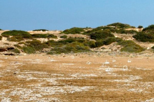 A visit to Northern Cyprus in the late summer is not complete without going to see the baby turtles hatching on the beach. 2008 was a good year for the turtles on Cyprus, there were approx 600 nests in all: 110 on Alagadi beach, 70 near Guzelyurt and 65 east of Kyrenia. About two-thirds of the nests were on the Karpaz peninsula.
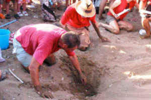 The turtles start to nest from late May and the hatchings begin 50-60days later so you may be able to see them hatching from mid July to the end of September.
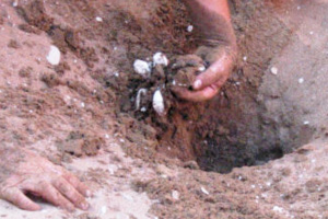 Since 1992 over 200 students and staff from British universities have taken part in the annual monitoring and conservation of marine turtles in Northern Cyprus. Work is carried out at the request and in conjunction with members of the local Society for the Protection of Turtles and the local Department of Environmental Protection.
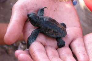 In the Mediterranean, only the green turtle (Chelonia mydas) and the loggerhead turtle (Caretta caretta) are known to nest. It is estimated that as few as 300-400 green and 2000 loggerhead females nest annually, both being considered as regionally endangered. Both species nest in Northern Cyprus.
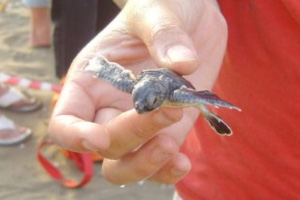 The hatchings take place almost on a daily basis, but it is advisable to call into, or phone the Turtle Project to ask if they are expecting a hatching/nest excavation.
The project can be contacted on 0392 815 2496 or 0392 815 5135 (00 90 392 815 2496 or 00 90 392 815 5135 from a UK mobile). You can also try Rebbo on 0533 8738248.
Nicosia (Lefkosa)
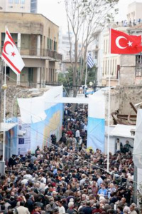 Nicosia, known locally as Lefkosa, is the capital and largest city in Cyprus, as well as its main business center. Nicosia is divided into the Turkish North and the Greek South with the “Green Line” (UN Buffer Zone) running through the middle of it. Since 2008 Ledra Street the main street which runs right through the divided city was re-opened enabling crossings on foot. The other crossing in Nicosia is The Ledra Palace Crossing. (Don’t forget your Passport).
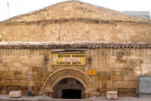 One of the world’s oldest cities, Nicosia was the center of an independent kingdom as early as the 7th century BC. Known in ancient times as Ledra, it came under Byzantine rule in the early 4th century AD and passed to Guy of Lusignan, the Latin king of Jerusalem, in 1192. The Lusignan kings held Nicosia until it was captured in 1489 by the Venetians. The city passed to the Ottoman Turks in 1571 and to the British in 1878. It was made capital of British-ruled Cyprus in 1925. Nicosia became the capital of independent Cyprus in 1960. The city has been divided since the Turkish Peace keeping Intervention in 1974.
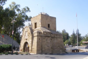
 Originally, there were only three gates into the city; the Paphos Gate, the Famagusta Gate (both in South Nicosia) and the Kyrenia Gate in North Nicosia. The Kyrenia Gate is the main entrance into North Nicosia, and the gate you will enter Nicosia through from the Northern side.
 The Old City with its museums and churches is pleasant, and due to the comparative lack of tourists, the city retains more of an authentically Cypriot air than the resorts of the southern coast. Fantastic little cafes invite you in for a Cypriot coffee, so just walk around and see the many woodworking shops that are deep within the City, and take a walk down to the Green Line, the boundary that now divides North from South.
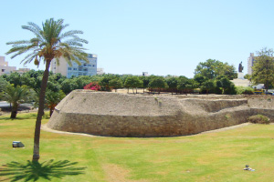
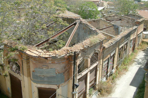
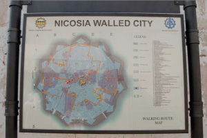 The Old City is surrounded by a picturesque star-shaped city wall whose moat has been converted into a pleasant park. Wandering around the Old City is an interesting experience in itself, although some buildings (especially those near the Green Line) are derelict and crumbling.
 Free Tours are offered on certain days each week, contact the Tourist Information offices at Kyrenia Gate. If you are unable to visit on those days, just follow the blue line painted on the pavement. This circular trail will take you past most places of interest, and at the Lokmaci Barricade (Ledra Street) crossing point, joins a similar trail of south Nicosia.
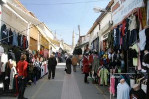 The Bazaar area by the Ledra Street crossing has stock of factory overruns, seconds and “copies” of designer clothes, some good some bad, but worth a stroll through.
Famagusta (Gazimagusa) Varosha
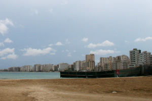 Famagusta was, in the 1960’s and 70’s the place to be on holiday, the St Tropez of its day, and a very important shipping port. However, after the Turkish peace keeping intervention in 1974, it became imbedded in the “dead” zone. Part of the town is still accessible via the North side and if you find the Palm Beach Hotel, this is at the most southern point, and go onto the beach you can look along the entire coast line of miles and miles which is known as Varosha, in the dead zone. It’s very eerie, buildings half finished in 1974 remain as they were, brand new Hotels, never opened and are now crumbling, tables set for meals, apparently there are still new Ford Cortina’s etc in the garages, but most relics are also reputed to have all been looted by the Turkish Army.
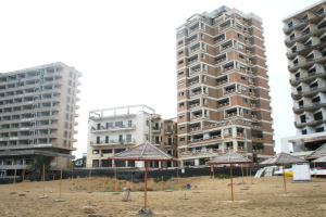 Note: In October 2020 the TRNC opened part of Varosha up to the public and laid new roads through part of it so you can now go in and walk around part of the ghost city. You can hire bicycles or scooters or even take a bus ride or just walk. You can also use one of the lovely beaches in there where there are sunbeds and parasols available for hire.
There are a number of Cypriot ruins, landmarks and Roman baths to be found within Famagusta, as well as some impressive monuments, royal tombs, monasteries, churches and mosques. The best of these landmarks include the Othello’s Tower, the Lala Mustafa Pasa Mosque and the Old Kirtikli Bathhouse (Kertikli Hammam).
 The historical Venetian Walls of Famagusta surround its Old Town area, defining its boundary. The Venetian walls were built to defend the city from possible attack, with 16 bastions dotted along the walls at strategic places. Tourists are able to walk along the Venetian walls, with the stretch around Land Gate being the most popular. From here, walk past the bastions of Diocare, Moratto, Pulacazara and Martinengo, towards Othello’s Tower and the Sea Gate.
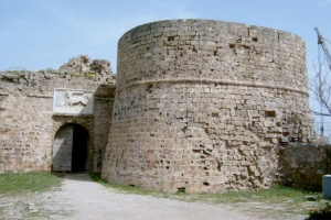 Othello’s Tower is perhaps the most famous of all the Famagusta landmarks and stands on the north-easterly corner of the Venetian walls, where it is also often referred to as simply the Citadel. Othello’s Tower is believed to have earned its name from a reference in the famous William Shakespeare play ‘Othello’, where a stage instruction mentions a ‘sea port in Cyprus’. The tower offers good views across the broken city and dates from the 12th century, being built under the Lusignan rule in order to protect both the harbor front and Sea Gate. It is commonly believed that when Leonardo da Vinci came to Cyprus in 1481, he offered some helpful advice about how the tower could be improved, and it was refurbished and reinforced shortly afterwards.
Castles
St Hilarion Castle
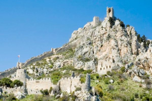 The original castle, to which the monastery gave place, formed part of the Byzantine defence of the island, which included castles of Kyrenia, Buffavento and Kantara also. The date of its construction is not recorded, but probably it was in the late 11th century. Alternatively, the building of the castle may have formed part of the measures taken by the Emperor Alexis I for the greater security of the Island, following a serious revolt in 1092.
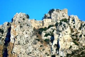 The castle is named after St. Hilarion, a hermit monk who fled from persecution in the Holy Land and lived and died in a cave on the mountain. Later in the 10th century the Byzantines built a church and monastery here. St. Hilarion Castle was originally built as a watch tower to give warning of approaching Arab pirates who launched a continuous series of raids on Cyprus and the coasts of Anatolia from the 7th to the 10th centuries.
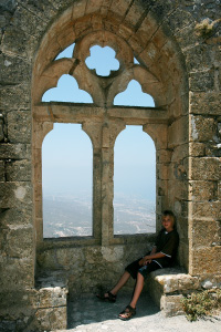 When the Venetians captured Cyprus in 1489, they relied on Kyrenia, Nicosia and Famagusta for the defence of the island and St. Hilarion was neglected and fell into oblivion.
 Today it is a major tourist attraction and every year thousands of people climb the hundreds of steps up to the highest point to experience the unique feeling of being on top of the world!
Once there you can sit and try to contemplate the sheer size of what had been achieved in constructing this awesome castle on top of, and into, the Kyrenia mountain range. You’ll be there a very long time!
Kyrenia Castle
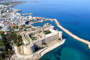
Photo courtesy of Highline Paragliding
Kyrenia Castle in Northern Cyprus, a Byzantine structure of four towers linked by walls stands at the entrance to the harbour at Kyrenia, guarding this North Cyprus port since the 1500s. Kyrenia has been inhabited since the 10th century BC. Excavations revealed Greek traces dating back to the 7th century BC, but the site was developed into a city under Roman rule.
Research suggests that the Byzantines built the original castle in the 7th Century to guard the city against the new Arab maritime threat. The first historical reference to the castle occurs in 1191, when King Richard the Lionheart of England captured it on his way to the Third Crusade. He did so by defeating Isaac Comnenus, an upstart local governor who had proclaimed himself emperor.
After a short period, Richard sold the island to the Knights Templar, and then to his cousin Guy de Lusignan, the former king of Jerusalem. This began the 300 years of the Frankish Lusignan Kingdom of Cyprus 1192–1489. Initially the castle was quite small. John d’Ibelin enlarged it between 1208 and 1211. The Castle’s main function was military and the improvements consisted of a new entrance, square and horseshoe-shaped towers, embrasures for archers, and dungeons.
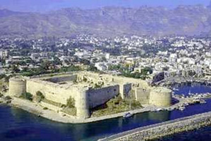 A Genoese attack in 1373 almost destroyed the castle, and the longest amongst the sieges, in the 15th century, lasted nearly four years and reduced the unfortunate occupants to eating mice and rats. By 1489 the Venetians had taken control of Cyprus and in 1540 they enlarged the castle, giving it its present-day appearance. The main changes, such as the addition of thick walls and embrasures for cannons, were adaptations to changes in warfare in the form of gunpowder artillery. The Venetians also installed gun ports at three levels so that they could direct cannon fire against attackers from the land, suggesting that they were more afraid of an attack from the Cypriots than from the sea. Its walls also encompassed the small church of St. George, which the Byzantines may have built in the 11th or 12th century.
In 1570, Kyrenia surrendered to the Ottomans. The Ottomans too made changes to the castle, but the British removed these during their occupation. The castle contains the tomb of the Ottoman Admiral Sadik Pasha. The British used the castle as a police barracks and training school. They also used the castle as a prison for members of the Greek Cypriot EOKA organization.
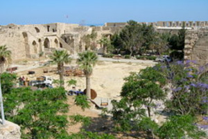 The Kyrenia Department of Antiquities took over custodianship of the castle in 1950, though it reverted to British control during the EOKA turmoil. The Department regained control in 1959 and since 1960 the castle has been open to the public. However, during the period from 1963 to 1967 the Cypriot National Guard used the castle as a military headquarters. Following the Turkish intervention of Cyprus, in 1974 the Girne Department of Antiquities and Museums took over responsibility for the castle’s preservation and use. The Department is keeping icons that were collected from churches in the Girne area pre-1974 and has stored them in the castle’s locked rooms for safekeeping. Some of these are now on display in the Archangel Michael Church.
It’s well worth climbing to the battlements of Kyrenia Castle, you can even walk around the entire castle walls, with care. The view from the castle across the harbour is amazing, just what the defending Venetians needed to check for that dreaded invasion. The irony is, when the Otoman invasion finally came in 1571, the Venetians gave up without a fight.
Buffavento Castle
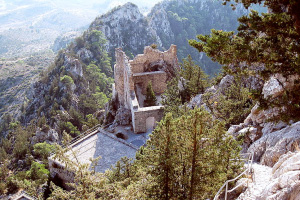 Buffavento Castle is built high in the Kyrenia Mountains of North Cyprus. Buffavento Castle is quite an imposing sight, perched on a rocky hilltop 950m above sea level. No wonder it’s name which is Italian, means “Defier of the Winds”!
Buffavento stands between St. Hilarion Castle to the west and Kantara Castle to the east. As both of the other castles are visible from Buffavento, it was used to pass signals between them. It also controlled an important pass through the mountains.
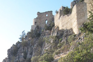 It probably originated as a Byzantine watch-tower, guarding against Arab raiders, and it is said that the Byzantine king Isaac Comnenus fled here when Richard the Lionheart invaded in 1191. The castle surrendered, and during the Lusignan period, Buffavento Castle was used as a prison, known as the ‘Chateau du Lion’.
Buffavento Castle then fell into disuse during the Venetian period, as coastal defences became preferable over mountaintop castles. The castle narrowly missed destruction during the disastrous North Cyprus fire of 1995, which destroyed 16,000 acres of forest around the castle site itself. Today, Buffavento is the least preserved of the three castles, but all the more atmospheric and rugged for it.
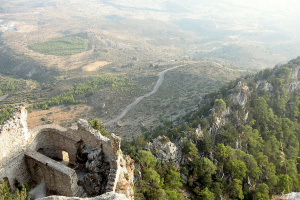 Buffavento Castle is on two levels. Walk through the lower arched entrance and you’ll see store-rooms and dormitories opposite, with a water cistern underneath. Take the stairs up from the gatehouse and a ten minute climb will bring you to the top level, with magnificent views, in the right weather conditions, of Kyrenia, Nicosia and Famagusta in North Cyprus, and even the Troodos Mountains in the south. The remains of a small chapel can also been seen here on the upper level.
Opening hours for the castle do vary, as the Turkish Army control entry days. If you turn down the track to the castle from the Bufavento Besparmak restaurant and the metal barrier is down, the castle is closed. Walking to the castle from the parking area takes around 20 minutes, and you pass a moving memorial to the victims of a light aircraft crash here in 1988.
Kantara Castle
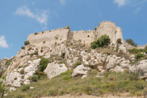 Kantara is the lowest and easternmost of the 3 castles of the Kyrenia Mountains in North Cyprus, and the easiest to get to. Rather than being high in the mountains, Kantara Castle sits on a range of hills just at the neck of the Karpas Peninsula, not far off the main road.
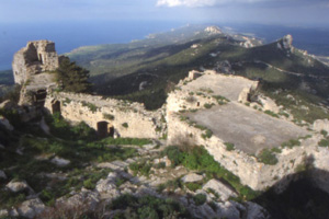 Lying at 630 metres above sea level, Kantara is well positioned to control the entrances to Karpaz Peninsula and Mesaoria plain. The name ‘Kantara’ is believed to derive from the Arabic word qantara, which means a small bridge.
It is believed that the Byzantines built the castle in the 10th century as a lookout post against raiding Arabs. The first historical mention of the castle is in connection with Richard the Lionheart’s capture of Cyprus in 1191. At that time, Isaac Comnenus, the Byzantine ruler of the island, took refuge at Kantara Castle. Later, in 1228 the Royalists so badly battered the walls that they had to be almost entirely rebuilt. During the time of the Genoese attacks in Famagusta, Kantara Castle became a refuge for those escaping the fighting. (The prince of Antioch escaped from Famagusta to Kantara Castle with the help of his faithful cook!) Later, the nobility used the castle as a lodge when they hunted mountain goats with tame leopards.
Museums
There are many Museums to visit in Northern Cyprus, here are a few local ones:
Peace and Freedom Museum (next to Escape Beach)
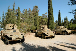
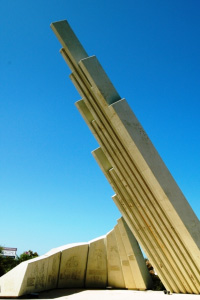 Travelling West from Kyrenia, just before Escape Beach and sited where the Peace Keeping Intervention was launched. A range of Armoured vehicles and artillery used during the intervention in 1974.
The museum is in two parts. The open air portion consists of a display of vehicles and arms left by the fleeing Greek soldiers, while indoors there is a display of photographs of the military action and uniforms of some of the participants.
We have not visited the museum ourselves, but have been advised that it is not suitable for children as there are some very graphic pictures.
Close to the museum is a small military graveyard holding the remains of some of the casualties, including that of Col Karaoglanoglu, the most senior officer to be killed in the operation, and whose name was given to the nearby village in his memory.
A short distance from the museum is a large monument at the actual point of the landings.
The Shipwreck Museum (inside Kyrenia Castle)
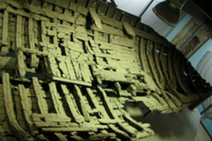 This is the oldest shipwreck on display anywhere in the world. The sunken ship was built in 389 BC and was 80 years old when it met its demise! About 400 Amphoras (ancient wine vessels), 29 millstones and preserved food including almonds were found in this shipwreck that was thought to be a cargo ship from the Hellenistic period following the death of Alexander the Great. Around 300 pieces of lead found inside the ship show us that the ship was also used for fishing. It was found 1.5 km from Kyrenia, at depth of 18m and was found by sponge fisherman in 1965.
Icon Museum
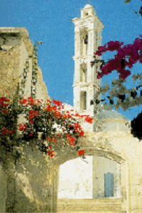
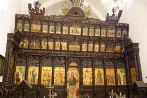 The former Arkhangelos Church is being used as an icon museum to exhibit the icons collected from Kyrenia and the vicinity. The church was built in 1860. A belfry, added to it twenty five years later can be viewed from all around Kyrenia.


